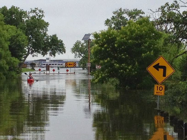
In the meantime we slosh through water, which is everywhere. We are fortunate that there have not been any catastrophic problems in the immediate area, but Lewisville Lake is definitely flooded. According to this site from the Army Corps of Engineers, Lewisville Lake was approximately 534 feet at noon today, which is 12 feet above the conservation level (522 ft) and 2 feet over the spillway (532 ft). These numbers are interesting, but we wanted to have some feel for what that level of flooding actually meant so we decided to check it out in person this morning. The approximate locations of the sites referred to in this blog are shown on the following map (blue push pins). (Here also is a link to an interactive Google map, but I did not know how to attach pins to that map.)
1. Lake Park Road at Lewisville Lake Golf Course. First up was a trip to the end of Lake Park Road, essentially the eastern extension of FM 407. The golf course is closed due to the water, although we saw multiple herons feeding in the ditch along the road and 5-6 Canadian geese camped out on the soccer field.
The flooding is clearly evident from the turn around at the end of the road.
 |
| View from the turn-around at the end of Lake Park Road (extension of FM 407) in front of Lake Park Golf Course, looking north towards the day use area. There is a road that runs perpendicular to this shot just beyond the large solitary tree to the left of center. The road is totally submerged, but can be seen in the street view on Google maps |
street view on Google maps. If you look carefully you can see the lake in the distance. Note the park road which is currently submerged in our pictures.
2. Lake Park We looped around to the entrance to Lake Park, which is in front of the disc golf course. It is now definitely a "Lake Park".
 |
| Next to the fee station at Lake Park |
 |
| Looking along the road into Lake Park from the fee station |
 |
| First hole of disc golf course from the tee |
 |
| Looking north along Mill Street. |
5. Copperas Branch Park East. I had reported in an earlier blog about the new park, Copperas Branch Park East, that is not yet officially open but is being developed as part of the renovation of Interstate 35E. We decided to check that out on our way home. We had seen on previous occasions that access to the boat houses near the trail head was under water, but we were shocked upon our arrival to see that even a corner of the new parking lot is now under water.
The trail along the railroad that leads out to the park is also partly under water in at least one place, so we did not even try to make our way out to the park. I doubt much of it is above water anyway.
I don't know what to expect about the water level. The Corps is still dumping water into the Trinity upstream out of Lake Ray Roberts, but they are not letting as much water out of Lewisville Lake because of flooding downstream near Dallas.


No comments:
Post a Comment