Saturday, January 24, 2015

Salton Sea Part 2 - Bombay Beach and Salvation Mountain

We enjoyed our brief stop at the State Recreation Area along the northeast shore of the Salton Sea, but we needed to keep moving because we were trying to outrun some winter weather that was descending into New Mexico and Texas in a couple of days.  However, we were still interested in seeing anything we could.

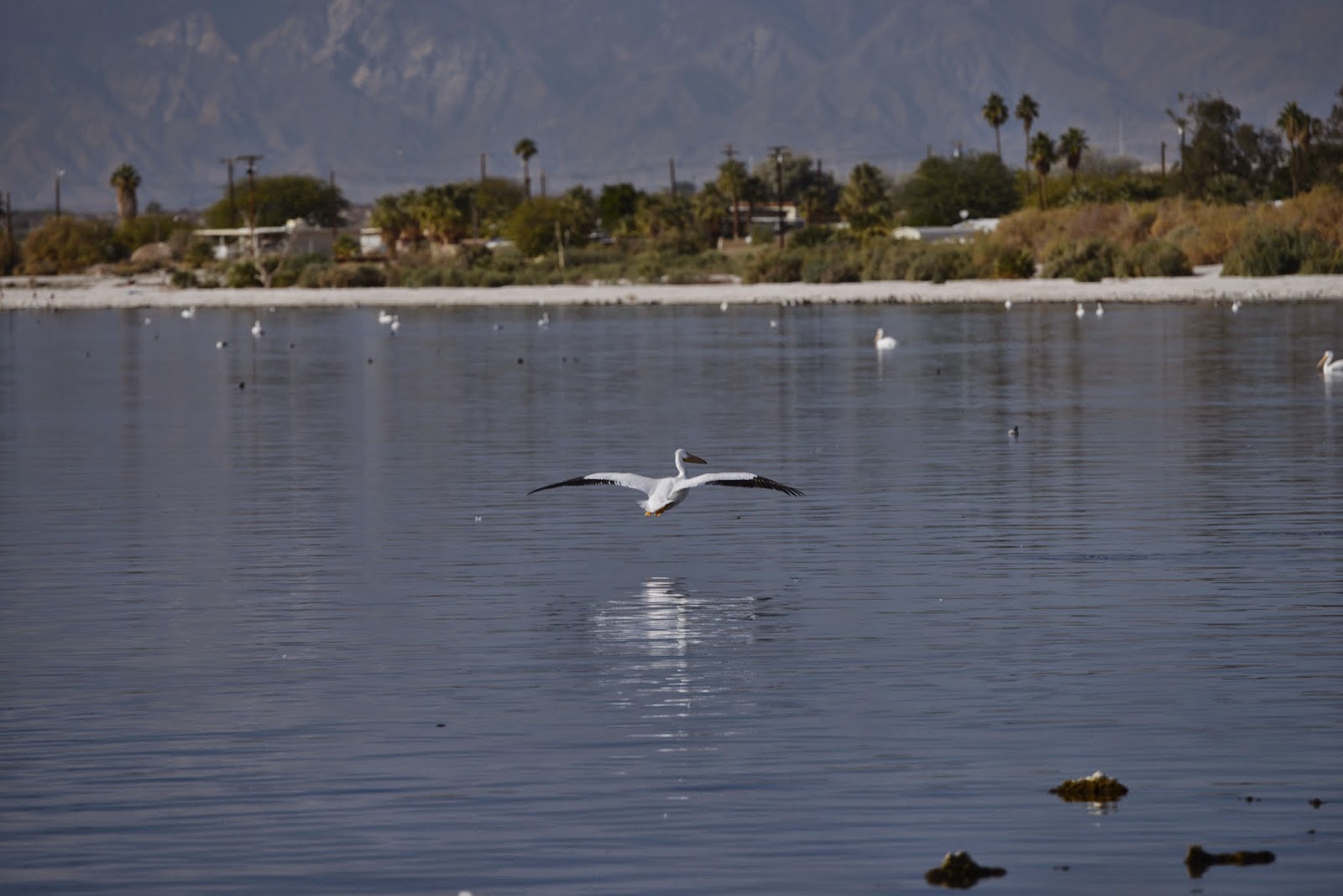
Before we left home I had briefly reviewed virtual geocaches in the area, not so much as targets for caching but as potential interesting items to see while we were in the area.  That turned up Slab City and Salvation Mountain near Niland, CA, a whole host of geothermal plants and bubbling mud pots south of Niland, and some interesting geology (pumice rock) along the southeastern shore.


Map from the Sonny Bono Salton Sea National Wildlife Refuge brochure

We thought that the information desk at the State Recreation Area might also be able to suggest something interesting.  The first and only thing out of his mouth was Bombay Beach, which I found on the map he gave us (see below) was along route 111 at the end of the State Recreation Area.
Map in the Salton Sea State Recreation Area brochure

I had never heard of Bombay Beach and knew nothing about it, but the person behind the desk also gave us the one page hand out shown below which helped a little.  With these two pieces of paper in hand, we headed out.

Hand out of things to do from the info desk at the Salton Sea State Recreation Area.


San Andreas Fault 

Route 111 heading south was an interesting drive.  It provided almost continual nice views of the Salton Sea.  There were multiple signs indicating potential flooding, presumably after rain.  There were also multiple channels or irrigation ditches cut perpendicular to the road that ran down to the sea.  Many of these looked newly cut.  We wondered if the recent rains had required reopening of some of these with earth movers of some type.

One thing we did not know until later was that the road, at least right in front of the entrance to the State Recreation Area, runs along the top of the San Andreas Fault.  This page has an interactive map of the location of the San Andreas fault.  Interesting to me was the fact that the southern end of the San Andreas Fault is near the eastern edge of the Salton Sea, 2.5 miles northwest of Bombay Beach.  I have ordered the  Field Guide to the San Andreas Fault (although it has not yet arrived) and hope to use that to plan some potential future excursions on return trips to California.  I had not realized that I-10 parallels it through the Coachella Valley.  We have also been quite close when we are on the far eastern edge of the Los Angeles basin.

I am not sure what will constitute the "Big One" in terms of earthquakes and where it will be.  However, I could not help but notice reference to the fact that the southernmost stretch of the San Andreas fault is thought capable of a magnitude 8 event, as large as any known California earthquake.  It was not by accident that the 2008 Great California Shakeout modeled a 7.8 earthquake originating near the Salton Sea.  The USGS paper outlining the shakeout scenario notes that major earthquakes in this area have occurred on average every 150 years.  The last one was 300 years ago.  Hmmm.....


Bombay Beach

As noted above, we did not know what to expect concerning Bombay Beach, but turned in at the large sign along the road.  I don't know what I expected, but what we found was not it, especially since it was a recommended stop by the state park.  As noted in a March 2010 article on mentalfloss.com, "Bombay Beach may be the most famously depressing place in California; the poster child for the post-apocalypse."  Post-apocalyptic is an apt description.


Picture from Wikipedia entry for Bombay Beach of a salt encrusted trailer on the water side of the dike in Bombay Beach.  ("Salton Sea homes" by Own work by User:GregManninLB. Original uploader was GregManninLB at en.wikipedia - Transferred from en.wikipedia; transferred to Commons by User:Atmoz using CommonsHelper.. Licensed under Public Domain via Wikimedia Commons - http://commons.wikimedia.org/wiki/File:Salton_Sea_homes.JPG#mediaviewer/File:Salton_Sea_homes.JPG)

Bombay Beach is a 10-by-10-block square of houses and mobile homes.  Incorporated in 1929, much of the town was flooded and destroyed by Hurricane Kathleen (and the Imperial Valley flood) in 1976 and Hurricane Doreen in 1977.  The worst part of the devastation is now behind a high dike.  We drove up over the dike to see what was left of the town on the Salton Sea side.  There the remnants of homes and trailers sit rotting, partially submerged in dried mud.

However, even on the "dry" side of the dike, many abandoned dwellings are interspersed among occupied homes.  Don't get me wrong, I love ghost towns.  Bodie, CA was one of the best places we have ever visited.  But this isn't really a ghost town.  It still has a population of several hundred people (295 at the 2010 census).  I think it was probably the mixing of abandoned dwellings and occupied homes that made this so depressing.

It was probably unjustified, especially since it was in the middle of a Sunday afternoon in broad daylight, but we felt very uneasy and did not linger even to take pictures.   I suspect we are not the only people to respond this way.  Numerous documentaries, movies, and tv shows have been filmed here.  It is the frequent subject of photographers, including a truly outstanding work of "light painted night photography" (not Photoshop!).  Bombay Beach is also supposedly the inspiration for the fictional town in the video game Grand Theft Auto V. (I am not familiar with Grand Theft Auto, but I could see how this would fit with my stereotype of what would be included.)  However the epitome of my reaction to Bombay Beach is captured in the fact that one of the occupied homes had "The Hills Have Eyes" scrawled on the outside.  Although we did not get a picture of the house, googling the term along with Salton Sea brings up plenty of examples.  I certainly saw it many times after I got home when I was looking for information online about Bombay Beach.  Of course, since I live in a cave, I did not understand what that meant until I looked it up.  Here is the description of the movie "The Hills Have Eyes" from the IMDb website:
A suburban American family is being stalked by a group of psychotic people who live in the desert, far away from civilization.
Yep, that was the feeling I had the entire time we were there.  Next time I will probably feel differently since I will know more about what to expect.  Perhaps we can stop at the Ski Inn ("lowest bar in the western hemisphere") where we can meet some of the locals and experience one of their famous greasy hamburgers. 

Salvation Mountain

Moving right along I set the gps for Salvation Mountain, our next destination.   Turning east at the intersection in the center of Niland, we followed the road for several miles to Salvation Mountain.

Although I had never heard of Bombay Beach, I was quite familiar (at least by reputation) with Salvation Mountain.  As described in Wikipedia, Salvation Mountain is an art installation covering a hill in the Colorado Desert, north of Calipatria near Slab City.

However, I was still surprised when seeing it in person.  A better description, now that I have seen it in person, is from an article in National Geographic last year

Salvation Mountain is a literal man-made mountain 28 years in the making, covered in half a million gallons of latex paint. What started as a small monument made of dirt and painted cement became, over time, a sprawling adobe and hay-bale mountain complex, with peripheral structures made of telephone poles, tires, and car windows, as well as art cars and sculptures, all painted in a patchwork of stripes and color blocks of whatever paint was donated that week.

Even having previously seen pictures, Salvation Mountain is much taller than I realized.

Salvation Mountain - note the people standing to the left of the cross and at other locations along the top.
 
 It also extends laterally for some distance.

more of Salvation Mountain

There is much more detail work on the outside than I had imagined.  


Some of the detail in the front of Salvation Mountain


Oops...I did not see this sign until later. 


The most surprising thing to me was that there was an interior to some parts of the structure.  This included meandering pathways through multiple rooms.


Inside a portion of Salvation Mountain
 

More of the inside of Salvation Mountain


The entire mountain was created by Leonard Knight starting in the mid-1980's.  He worked on it until his failing health required him to move to a nursing home several years ago.  Although Leonard died in February 2014, the Mountain is still not finished.  Volunteers continue work on maintaining the existing mountain and creating the museum and other parts he envisioned. The history of how all of this came to be is on the official Salvation Mountain website, but I especially like this description that appeared in The Economist in 2003.  The article is now somewhat dated, but it captures much of the essence of Salvation Mountain, at least as it appeared to me as an outsider:

IN THE fierce heat of the Californian desert, you feel as if you have seen Babylon: a shimmering hillside garden of cascading waterfalls, flowing streams and verdant trees. Once you get closer, you find that Salvation Mountain is actually a huge collage, 40 feet high and 100 feet wide, built on the side of a desert bluff from a mixture of adobe and household junk (kettles, refrigerators and great trees of used tyres) and then painted with garish animals, birds, flags and religious writings.
The aim of Salvation Mountain is appropriately Californian: to inspire people to love each other. Its creator, Leonard Knight, a gnarled veteran of both the Korean war and the 1960s, originally thought of celebrating his religious fervour by building and flying a 300-foot-high hot-air balloon. That project failed when the fabric rotted; so since 1985 he has been working on the mountain. So far, he has used up 100,000 gallons of paint.
Salvation Mountain stands at the entrance to “Slab City”, an old army base that has now been converted into a somewhat Mad-Maxish desert town—part trailer park, part new-age community. The residents of Slab City offer materials for the Mountain and sustenance for the artist, who lives in a couple of luminously painted trucks.
The Mountain has its disbelievers. In 1994 state officials tried to bulldoze it, claiming that the toxins in Mr Knight's paint were a health hazard. Soil tests proved them wrong, and now Mr Knight is dangerously close to respectability. Senator Barbara Boxer has described Salvation Mountain as a national treasure and “a sculpture for all the ages”. The Folk Art Society of America has declared the site “worthy of preservation and protection”.
On a good day it gets 150 visitors, each of whom is escorted up the bright yellow pathway that reaches the top of the bluff. For Mr Knight, the pervasive message is “God is love”, but he also sees his work as an antidote “to those people who tell you how you should deal with your spiritual side”. He begins to elaborate on this theme, but then stops. “I'm letting my mouth get in the way again. Let the mountain do the talking”. Which it does very well.
Turkey with the model of Salvation Mountain.  Leonard Knight's brightly painted trucks, his home for nearly 30 years before his death, are in the background.
Salvation Mountain is definitely a one of a kind place.

For more pictures of Salvation Mountain and its creator, Leonard Knight, see this photo essay by National Geographic photographer Aaron Huey.

Wednesday, January 14, 2015

Salton Sea Part 1 - Salton Sea State Recreation Area

On our trips home to Texas from Santa Barbara we normally drive east across I-10 from Blythe to near Buckeye (just west of Phoenix), then cut down to I-8 to go around Phoenix.  This time, just to see something different, we thought it might be interesting to cut down to I-8 earlier by going along the Salton Sea.

We usually do lots of preparation (many would say over preparation) for our travels.  This time, due to unpredictable weather and unpredictable traffic, we did not know if it would be practical to take this alternate route or stop to see any sights even if we did.  Therefore we did very little pre-planning.  We saw some interesting new locations and got an overview of a new area, but in retrospect missed seeing quite a few interesting things. 

One of the few decisions we did make ahead of time was to go south along the eastern shore of the Salton Sea in hopes of stopping at the Salton Sea State Recreation Area even though it looked to be the slower route on the map. We knew almost nothing about the Salton Sea other than it was a major stopover for migratory birds.

Area map from the Sonny Bono Salton Sea National Wildlife Refuge brochure
 
We left early Sunday morning, December 28, which turned out to be a wise choice.  Traffic was exceptionally light for most of the trip along the northern edge of the LA basin.  We stopped in Indio for lunch one exit before the turn off to the Salton Sea. That turned out to be good since it is not obvious we would have had many (any?) choices once we turned off the interstate.

Traffic had been manageable before turning off the interstate.  Now there was essentially no traffic as we skirted around Coachella and Thermal.  Highway 86 was a very good, divided highway, but was nearly deserted.  It also had the strangest left turn lanes we had ever encountered.  The landscape was very dry and dusty, although there were occasional palm tree plantations.  We left 86 and turned east to proceed south on 111.

Salton Sea State Recreation Area


First stop was the Salton Sea State Recreation Area.  We did not know until later that the visitor center is only open on Friday, Saturday, and Sunday, so we were lucky to pass through on a Sunday.  At the visitor center we watched the short film that presented a history of the Salton Sea, then headed out to check out the sights.


Frog in front of the visitor center

There was a large parking lot with a few RV hookup spots along the side.  There was also a small marina behind the visitor center and a location to rent boats and kayaks.  However, the big draw here was the Salton Sea.  A few folks were fishing, but most people were watching the birds.

On the beach near the visitor center at Salton Sea

The park info claims there are more than 400 species of migrating birds that spend time here between October and May.  I presume that includes some of the small birds I could hear, but not see, in the palm trees near the visitor center.

We did see a variety of birds on the water.  The most abundant of those were the white pelicans.  We had certainly seen pelicans before, but those had been brown pelicans, not white.

white pelican

More pelicans on the Salton Sea
Although totally white while floating on the water, it was easy to see their black tipped wings when they were in flight.


white pelican in flight

white pelicans and a brown pelican


Looking back across the beach towards the parking lot from the shoreline


Formation of the Salton Sea


The area within the Imperial and Coachella Valleys known as the Salton Sink has been flooded many times through both geologic and historical times.  Some of these seas were much larger and deeper than today's version.

The current sea was somewhat of an accident.  In 1905 irrigation canals fed from the Colorado River flooded, creating the Salton Sea.

Map from the Salton Sea State Recreation Area brochure

Here is the description from Wikipedia:

In 1900, the California Development Company began construction of irrigation canals to divert water from the Colorado River into the Salton Sink, a dry lake bed. After construction of these irrigation canals, the Salton Sink became fertile for a time, allowing farmers to plant crops.

Within two years, the Imperial Canal became filled with silt from the Colorado River. Engineers tried to alleviate the blockages to no avail. In 1905, heavy rainfall and snowmelt caused the Colorado River to swell, overrunning a set of headgates for the Alamo Canal. The resulting flood poured down the canal, breached an Imperial Valley dike, and ran down two former dry arroyos: the New River in the west, and the Alamo River in the east, each about 60 mi (97 km) long. Over a period of about two years, these two newly created rivers sporadically carried the entire volume of the Colorado River into the Salton Sink.

The Southern Pacific Railroad attempted to stop the flooding by dumping earth into the canal's headgates area, but the effort was not fast enough, and the river eroded deeper and deeper into the dry desert sand of the Imperial Valley. A large waterfall formed as a result and began cutting rapidly upstream along the path of the Alamo Canal that now was occupied by the Colorado. This waterfall was initially 15 ft (4.6 m) high, but grew to a height of 80 ft (24 m) before the flow through the breach was finally stopped. Originally, it was feared that the waterfall would recede upstream to the true main path of the Colorado, attaining a height of up to 100 to 300 ft (30 to 91 m), at which point it would be practically impossible to fix the problem.


As the basin filled, the town of Salton, a Southern Pacific Railroad siding, and Torres-Martinez Native American land were submerged. The sudden influx of water and the lack of any drainage from the basin resulted in the formation of the Salton Sea

The Salton Sea is a very interesting place.  It is actually much larger than it seemed on first observation.  It is currently about 35 miles long and 15 miles wide.  It is quite beautiful, a calm lake (or as the locals like to point out repeatedly, actually a sea) surrounded by a white beach and mountains in the background. It is no wonder that in its heyday in the 1950's it was a very popular resort spot and celebrity hangout, with more tourists annually than Yosemite National Park. 

However, there are some issues


Salinity.  The Salton Sea is a landlocked extension of the Gulf of California.  There is some water flow into the sea, but there is no outflow.  Primary loss of water is through evaporation.  The water is therefore becoming increasingly salty.  The lake's salinity is about 54 g/l, which is greater than that of the Pacific Ocean (35 g/l) but less than that of the Great Salt Lake (which ranges from 50 to 270 g/l). The concentration has been increasing by about 1% per year.


The increasing salinity over the years has resulted in the death of most original species of fish.  Essentially the only fish surviving are tilapia.  Although they exist in large numbers, there are periodic fish kills due to algae blooms.  The remains of dead fish, partly preserved by the high salinity, are everywhere along the shore.  The smell was not bad while we were there, but it is supposedly quite bad during the warmer months.

Heat.  Speaking of "warm", the Salton Sea is very low in elevation, officially 228 feet below sea level!  It therefore is VERY hot in the summer.  The  average temperature in June is 103°F, with a record high temp. of 121°F, and in July the average is 107°F and a record high of 122°F.  Only Death Valley is hotter, with the highest official temperature ever recorded on earth of 134°F.

Yep, that is -228 feet.  Only place in the U.S. that is lower is Death Valley at -282 feet.

Humidity.  But it is a dry heat, you say.  Wrong!  Due to the Salton Sea, the humidity is actually quite high, often greater than 90%!


From the Salton Sea Walk website: http://www.saltonseawalk.com/

With real high temperatures averaging 103-107°F, but possibly closer to 120°F, and humidity levels greater than 90%, the heat index is much higher than at very dry Death Valley.  After trying to look up the heat index values for such a combination of high heat and high humidity on the Wikipedia heat index page (see chart below), I think the values for these combinations of heat and humidity at Salton Sea can be officially considered "off the charts".  I did not use the NOAA supplied equations to extend the chart, but some of those values are available here.  They are in excess of 150°F. 

NOAA national weather service: heat index
temperature (°F)
80 82 84 86 88 90 92 94 96 98 100 102 104 106 108 110
Relative Humidity (%)
40 80 81 83 85 88 91 94 97 101 105 109 114 119 124 130 136
45 80 82 84 87 89 93 96 100 104 109 114 119 124 130 137
50 81 83 85 88 91 95 99 103 108 113 118 124 131 137

55 81 84 86 89 93 97 101 106 112 117 124 130 137


60 82 84 88 91 95 100 105 110 116 123 129 137


65 82 85 89 93 98 103 108 114 121 128 136


70 83 86 90 95 100 105 112 119 126 134


75 84 88 92 97 103 109 116 124 132


80 84 89 94 100 106 113 121 129


85 85 90 96 102 110 117 126 135


90 86 91 98 105 113 122 131


?? ?? ??
95 86 93 100 108 117 127


?? ??

100 87 95 103 112 121 132


  Caution
  Extreme Caution
  Danger
  Extreme Danger


And there is more. It is not just the salinity, heat, humidity, and decaying fish.  The white beach is not what it appears.  It is not sand, but barnacle shells and fish bones.  The barnacles were apparently introduced by military sea planes using the Salton Sea for exercises during World War II.  With no natural predators, they have flourished.  It was not a problem for us with shoes, but they are sharp.  I could pick them up in my hands without an issue, but they are not appropriate for bare feet or even flip-flops.  While we were there the volunteer behind the desk was warning a visitor not to take his dog on the beach to prevent him from cutting his paws.

And it is only going to get worse.  According to one site, the Salton Sea loses about 66 inches per year due to evaporation.  It only gets about 3 inches of rain.  I don't know how much water has been flowing in, but not enough to maintain the size of the sea.  It has shrunk considerably over the last several decades.  Current changes in water appropriation will further decrease the inflow.  I don't know by how much or at what rate, but that suggests the Salton Sea will get significantly smaller and significantly more saline in the foreseeable future.

It sounds like this is a horrible place.  That is not true.  It was beautiful while we were there.  I would have loved to have spent more time exploring and watching the birds.  I am glad we saw it before the various problems got any worse and hope we will be able to visit again in the future.  However, I don't think I would care to be there in the summer.  

Salton Sea Walk:  6 Days - 116 Miles - 120°F - June 2015


Although I don't plan to be there in the summer, I will be following an event this June.  In researching the Salton Sea I stumbled across the website, Salton Sea Walk.  This is the website created by Randy Brown, who is planning to walk around the shoreline of the Salton Sea this coming June.  If successful, he will be the first person to do so.  (This will be harder than the walk around the Salton Sea done using paved roads by Dinesh Desai in 2005.)

Although I first thought it sounded crazy, Randy is carefully planning everything and is documenting his training/exploration walks along the shore.  It is interesting reading. I will be cheering him on and wishing him well, but not in person.  Salton Sea Walk, 6 Days - 116 Miles - 120°F - June 2015.

Tuesday, January 13, 2015

Stupid Squirrels

Before talking about the new sights we saw on our way back to Texas, I wanted to provide an update on the wildlife in our backyard.

When we returned home, not surprisingly both bird feeders were empty.  We filled them and the birds quickly returned.  We also added our new feature, hanging corn for the local squirrel population.

Ten pounds of corn from Home Depot


Corn attached and ready to be hung

We used the hanger already in place for the hummingbird feeder, since that is only needed during the heat of the summer. 


Temporary location using existing hanger on patio roof.  This is with original amount of chain, hung to maximum length.


Unfortunately, the weather was cold and rainy so we did not see any squirrels.  We assumed they were hiding someplace trying to stay warm and dry.  Even when one finally did venture onto the patio for water (one of the few days in this stretch when the water was not frozen), the squirrel did not seem to notice the corn.  As per the instructions, we added more chain to lower the corn to a height of about 1 foot and added peanut butter.

This seemed like a good use for peanut butter that was past its freshness date, but had never been opened and seemed fine.  Perhaps our squirrels prefer chunky rather than creamy?!


We still did not see any squirrels, probably because the weather continued to be a major deterrent to them being outside much at all.  However, we did notice one morning that the peanut butter was completely removed, although (except for a couple of kernels on the ground) the corn remained untouched.

I continued to replace the peanut butter and it continued to disappear at night.  Hmmm...squirrels are not nocturnal animals.  Who is eating the peanut butter?

Eating breakfast yesterday morning at about 6:20 am (when it was still totally dark) we saw this when we went to investigate what had triggered the motion detector light.


The pictures are very poor due to trying to hold my iphone steady in such very low light without a flash because it was through the patio door.  However, it is still clear enough to see that it is the "baby" opossum we had seen a month ago.  I noticed earlier when Alex had gone out that the peanut butter was already gone before the opossum arrived.  I don't know if he had been around earlier or if some other nocturnal animal had been helping himself to some of the backyard smorgasbord.  The weather is to be warmer later in the week.  Hopefully some of our mentally challenged squirrels will be out and about and find the corn.

Sunday, January 4, 2015

Palm Springs Wind Farm Tour


We wanted to build some slack into our Christmas trek to Santa Barbara.  Google maps estimates it takes 22 hours of driving without traffic.  We have done the trip in two long days, but that almost guarantees heavy traffic in the dark at the end of the trip this time of year.  Since we so rarely get to see the ocean, it is awfully nice for the trip along the coast to be in the light, not to mention it has got to be safer.  We decided to plan for 3 days, but adjust accordingly depending upon weather or other problems.  We therefore began to look for possible things to do near Los Angeles in case the trip went quickly.  We had never stopped in the Palm Springs area, but thought that might be a good target for a stay on the second night...certainly doable with the additional hours going west due to time zone changes, but not written in stone in case we had weather delays or other problems. 

If we did make it to the Palm Springs area for the second night, was there something of interest to do to avoid driving through Los Angeles too early the next day?  What about a tour of the wind mill farm in San Gorgino Pass along I-10? I did not know if such a tour even existed, but quickly discovered two such tours online.  One seemed to be the same company that provides many celebrity home tours throughout the Palm Springs area.  However the other, Palm Springs Wind Mill Tours, was devoted exclusively to wind mill tours and claimed to be the only one to go behind the fence onto the wind farm property.  I was also pleased to see that we could easily check for and reserve available spots for their tours online, a big plus while on the road.  

Once we arrived in Palm Desert on Monday night, we made our reservations online and were ready for Tuesday morning. First we needed dinner.  Based on our brief look online, we thought we would need to get in the car and drive, never a welcome option after being in the car all day.  Fortunately the front desk told us about Roc's Firehouse Grille across the street.  What fun that turned out to be.  One of the local radio stations, 93.7 KCLB, was hosting their onsite event for Monday night football.  That included free raffles and lots of craziness.  (Who wouldn't lust after an Oakland Raiders sippy cup?!)  We especially liked the shirts worn by the waitresses.  On the back was "Stay back 200 feet". We did not stay long, but it was definitely fun.


On Tuesday morning we drove the additional 15 miles or so and easily found the site on the I-10 service drive for Palm Springs Wind Mill Tours. We were plenty early for the 9 am tour, but enjoyed looking at the many pictures in their waiting area.  Who knew that the wind turbines here dated back to the early 1980's?! This wind farm in San Gorgino Pass is not the largest wind farm in California.  That is the Alta Wind Energy Center a bit further north in Tehachapi Pass, apparently the largest wind farm in the U.S. (Although the farm in Tehachapi Pass is the largest, Texas appears to still be first in total generation by state.)

We also spent some time talking to the two tour guides.  Unbeknownst to us, they had only been in business for about two months and were definitely doing everything they could to please their customers.  There was only one other couple on this tour, two people from Michigan, so the four of us had ample opportunity to ask lots of questions.


The guides provided a description of the pictures, which was an historical overview of development of wind turbine design and wind generation.  Based on the multiple pictures of catastrophic failures, this was not always a straight-forward process.  I had not realized that not only did the entire turbine rotate to align with the wind, but each blade also rotates about its axis.  The turbines are only allowed to operate if the wind is strong enough to generate electricity but not too strong to damage itself. That explains some of the non-rotating turbines we have observed.  They also explained how some designs point in what appears to be the "backwards" direction, i.e. an older design (a few still operational in the valley) had the generator box in front of the blades.  Current designs seem to be blades first, the so-called "upwind" design, to avoid the problems of wind turbulence on the blades from going around the generator box.

The turbines were definitely turning today.  The wind was blowing hard and, apparently unusual for wind in the morning, was coming from the east. Wind here normally blows from the west in the morning and the east in the afternoons.  It was also unusual to have this much wind in December.  San Gorgino Pass has lots of steady wind, but its peak wind season is February to September.  That makes it unusual for wind farms in that its peak generation season is during the summer when electrical demand is usually at its highest.

Different kinds, different sizes and possibly even different wind mill farms


Closely spaced running north and south, but spaced out east and west so that they do not feel turbulence created from the upwind turbines


Southern California--beautiful snow-capped mountains even in this dusty, dry desert

We proceeded outside for several hands on displays, then climbed onto the bus for a trip by multiple types of turbines. We also stopped at a solar facility owned by an Asian company.

Solar panels facing away from us at the North Palm Springs 1 solar site, 61125 Dillon Road, plus LOTS of wind turbines.

Using the bus as a stepladder to shoot over the fence
 
Looking south across the west end of the solar project to a line of turbines on the south side of I-10.  I like the "spikey" image of the aligned turbines in the distance.


Some of the approximately 2000 wind turbines in the valley and on the crests of the hills, scattered among the creosote bushes.  The actual number is constantly changing as older models are removed and replaced by newer, larger, more efficient turbines.

We also pulled up to the new 800 Megawatt CPV Sentinel Energy Project natural gas peaking plant, which just went operational in May, 2013.  It will generate electrical power from natural gas, but only when needed.  The plant has eight quick-start natural gas-powered turbines that can start up in 10 minutes to support the Southern California electricity grid and should prevent brown-outs and black-outs experienced in the past.  We did not get pictures of the peaking plant, but do have pictures of an older peaking plant behind the largest of the current wind turbines.

Older peaking plant and shorter turbines in the background.  New 3 Megawatt turbine in the foreground.
Finally we got out to stand near the largest of the wind turbines.  It is 440 feet tall, but does not seem nearly that big since there is nothing near it. Despite their reputation, it was not noisy.  In fact, the interstate in the distance and some random jets overhead were much louder.

One of the newest wind turbines in the area: a Vesta v90 wind turbine, 3 Megawatt, 440 feet tall.  The rotor diameter is 90 m (295 feet).  The generator/gear box (nacelle) at the top of the pole is larger than the portable building used for the windmill tours.

These are the largest land based wind turbines currently in use.  Although the weight of the blades is somewhat of an issue, the real limiting factor in size is the length and size of the blades.  Anything larger apparently cannot be transported on U.S. highways.  Larger turbines are in use offshore since the components can be delivered via ship.

I've only barely scratched the surface with the information they provided us.  The bottom line was that we really enjoyed the tour.  My only minor regret was the inability to get close to one of the larger blades such as those along the highway in Sweetwater, TX.

Not sure how these blades in Sweetwater, Texas compare to those in Palm Springs.  This one blade weighs 16,000 pounds.

One additional note:  although we went by while on the tour we did not stop at Windmill Market and Produce on the corner of North Indian Canyon Road and Dillon Road.   They are supposed to have the best date shakes in Coachella Valley.  I guess we will just have to go back!  The windmill tour company has already sent us a 10% discount for a return visit.

The gps track of our tour on a satellite view from Google Earth.  I-10 runs east and west. The exit to the west is Route 62.  The exit to the east is North Indian Canyon Road.  The tour started at the tour building and went clockwise.  The tour building site is on the west bound service drive just north of I-10 with all of the track points clustered north of it.  Point #001 (upper left) is where we stopped to view the solar facility.  The road running east from point 001 is Dillon Road. The facility to the north is the new gas peaking plant.  The new large turbines are east of the north-south track, east of the tour building.