 |
| Physics group (sans Doug and Diane): Glenn, Cliff, Ruthanne, Pat, Ron, Cheryl, Jeff, and Dave |
Now what?
We still had another day on our motel reservation. We knew we could always bug out early, but we had still not gotten to see Fort Sumter. Perhaps it was because it was the only thing I had known about Charleston before this visit, but Fort Sumter was the one thing I had hoped to see while in Charleston. The crowds in town seemed to be thinning out and we were within walking distance of the tour departure point at Liberty Square, so off we went to find out about tickets.
Waiting for the Fort Sumter Tour Boat
Fort Sumter is on a tiny island about three miles from the tip of the Charleston peninsula at the opening to Charleston Harbor. It is a National Monument and there is no charge to enter the fort, but the only access is by boat.
Boat access is by Fort Sumter Tours, which require a fee. The boats depart from both Liberty Square (the area on the Cooper River near the aquarium) and across the river at Patriots Point. Tours last 2 hours and 15 minutes, including an hour at the fort.
What we had discovered when the Frog had walked to the ticket office at Liberty Square the previous afternoon after the eclipse was that on August 21 they had gone to their fall hours, i.e. only two tours a day. By the time we arrived this morning, we were too late for the 10:30 tour, but there were still tickets for the last tour at 1:00 pm. Ok then, 1 pm it is!
We took in the sights in their small museum at the facility at the dock, the Fort Sumter Education Center. The museum would have been fine, other than being very small, except the air conditioning was not functioning very well. With lots more time to kill, we walked towards the aquarium and noticed another public building next door. We walked in and found out it was part of the College of Charleston. It was only later that I discovered this area, known as Harbor Walk, is a commercial and retail area around the aquarium. The College had rented 45,000 square feet of space for Physics/Astronomy, Biology, and Computer Science while they were remodeling space on their campus across town. We grabbed some cold drinks from their kiosk and hung out for awhile.
As the tour departure time approached, we made our way back to the dock. That turned out to be a good thing, since the tour was again sold out and there ended up being a long line to get on the boat. By being near the front of the line we were able to snatch an outside seat on the top level, what we thought would be better for pictures. I think I heard one of the rangers say there were 400 people on the boat, so it took awhile to get everyone off and then onto the boat.
 |
| The tour boat returning with the morning's tour group. The top level is covered but outside. The first two levels are inside and air conditioned. |
Cruising out to the fort
Although the tour is to see Fort Sumter, there is also quite a bit to see on the trip out and back.
 | |
| GPS track of our trip to Fort Sumter |
First up was a nice view of the Arthur Ravenel Bridge, which takes US 17 over the Cooper River. The bridge, which opened in 2005, is quite striking.
 |
| Arthur Ravenel Bridge |
We also got a better view of the aircraft carrier USS Yorktown across the river at Patriots Point.
 |
| USS Yorktown |
 |
| Water front condos |
Fort Sumter
It wasn't long before the fort came into better view.
The fort was bombed into a pile of rubble during the Civil War. What is now on site represents several iterations of rebuilding since then, including remodeling in case it had been needed (it wasn't) in the Spanish-American War.
 |
| Aerial view from https://en.wikipedia.org/wiki/Fort_Sumter |
 |
| GPS track |
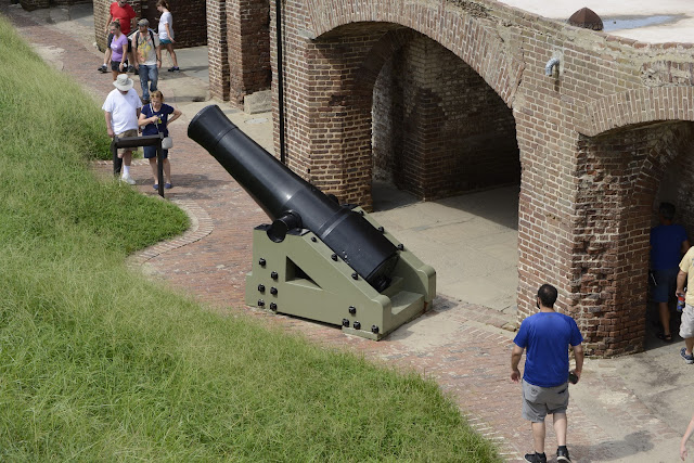
Several things struck me in exploring the fort.
(1) The entire fort is not very big. We did not go into the museum or the other buildings (all with the black roof in the aerial photo), but the footprint of the entire island is very small.
(2) At least as it exists now, it is not especially imposing looking from the water. Given the sunken area in the center, it is more of a fort than in looks from the outside, but it is still small.
 |
| View of the outside of Fort Sumter from the tour boat |
(3) Although you can certainly see downtown Charleston and the church steeples from the fort, it looks somewhat distant.
 |
| Downtown Charleston as seen through one of the artillery holes at Fort Sumter |
(4) Despite its distance from downtown Charleston, it is really close to land to the east, west, and south. For example, Fort Moultrie, is only a mile away and is easily visible from Fort Sumter It is no wonder artillery from these locations caused so much damage.
 |
| Fort Moultrie on the east side of the Cooper River as seen from Fort Sumter |
Back to Charleston
We took our time wandering around, then finally made our way back onto the boat. Once they got everyone aboard, we were off to Charleston.
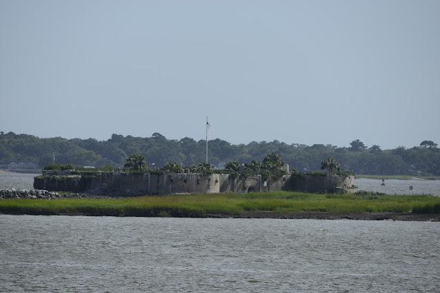
One of the things we did see on our way back was yet another fort on what my gps identified as Shutes Folly Island.
 |
| Castle Pickney on Shutes Folly Island |
A Google search indicated this was Castle Pickney, a former fort that at one time was a National Monument. However, the federal government deemed it more expensive to maintain than was justified by its limited historical value, so that designation was later removed. It has had various owners since, but now seems to be maintained (and I use that word loosely) by Sons of Confederate Veterans.
I was intrigued by the flag flying over the fort.
It turns out it was another type of Confederate flag, the so-called "Second National Flag"" of which I was not familiar.
 |
| From one of the plaques at Fort Sumter |
Return to the 21st Century
As our tour boat moved northward we left these historical forts behind and we slowly returned to the 21st century. As we were moving into the dock, we could see an enormous cargo ship just to the north with lots and lots of cars on the dock.
I thought I heard someone near us say they had seen them loading cars onto the ship earlier in the day.
Sure enough, a close in shot of the cars indicates they are BMWs and at least some of them are X5s. According to Wikipedia, the BMW assembly plant in Spartanburg, South Carolina, is the sole global production site for X3, X4, X5, and X6 crossover SUVs. In 2015, 250,000 cars were sent by rail from Spartanburg to the Port of Charleston. I would love to know how many go onto that one enormous ship.
As with almost everything in Charleston, the ride out and back to Fort Sumter had been hot and humid. However, it was well worth the trip. I learned a lot and am glad we went. It was a good way to end our stay in Charleston.


No comments:
Post a Comment