Early morning return trip to White Sands
As noted in more detail in the previous post, we enjoyed a quick return trip to White Sands early on a Sunday morning.
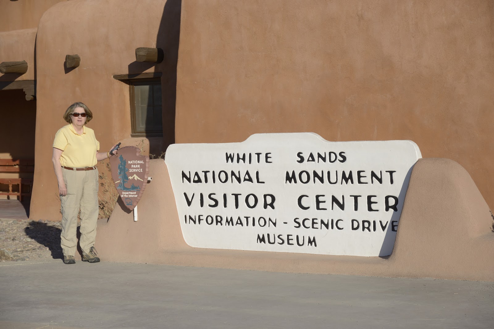 |
| Obligatory pic with gps for terracache log |
Climbing into the mountains
It was nice to have White Sands nearly all to ourselves, but we quickly headed east for new adventures. We took US 82 east out of Alamogordo to Cloudcroft. This turned out to be a very scenic route, but steep--approximately 5000 feet of elevation gain in 16 miles. Over that relatively short distance, we went from the Chihuahuan Desert at the bottom to the alpine climate of Lincoln National Forest at the top.
Cloudcroft Tunnel Overlook
An unexpected treat was a scenic overlook (with nice parking) at the "Cloudcroft Tunnel" approximately half way up the climb to Croudcroft. This allowed spectacular views back down Fresnal Canyon towards Alamogordo in the Tularosa Basin below. Clearly visible are the brilliant white sands of White Sand National Monument in the distance. That was in spite of the considerable amount of dust in the air in the basin due to strong winds.
 |
| View to the west from Cloudcroft Tunnel overlook |
Mexican Canyon Trestle
Another unexpected treat was the view of the Mexican Canyon Trestle, just outside of Cloudcroft. The trestle was originally built in 1899 as part of the Alamogordo and Sacramento Mountain Railway or "Cloud Climbing Railroad", but only recently restored in late 2011. There is a very nice turnout with lots of parking and interpretative signs.
 |
| Mexican Canyon trestle from vista overlook on US 82 |
The railroad was built to haul lumber out of the Sacramento Mountains. The railroad was built before roads existed and even before the area was mapped. I found this description online:
The Alamogordo and Sacramento Mountain Railway traveled between Alamogordo and Cloudcroft and was built 13 years before New Mexico became a state. Though primarily used for hauling lumber, passenger excursions could be purchased for $3 round-trip from El Paso and the money supplemented the income from hauling logs.
Moving at a slow crawl for much of the trip, trains pulled passengers and cargo up steep 6 percent grades and through hairpin curves. The trains traveled 26 miles over 58 trestles and climbed to 8,600 feet, making the A&SM railway the highest standard gauge track of its time. Throughout the years, the introduction of internal combustion engine trains and a state highway led to the decline of the railroad and in 1947, the tracks were torn up and sold as scrap."I did not find out until later, but much of the original rail bed has been converted into a system of hiking trails, the Cloud-Climbing Rail Trail, as part of the Rails to Trails program, including a short trail that goes from Cloudcroft to the backside of the Mexican Canyon Trestle.
We did not spend a lot of time here, because it was actually rather cold due to the strong wind and high altitude. Despite the cold, this was a very interesting stop.
NM 6563 -- Sunspot Scenic Byway
Our next destination was the National Solar Observatory on Sacramento Peak in Sunspot, NM. Access was via New Mexico route 6563, a 16 mile trip from Cloudcroft to Sunspot. This, like so much of the day, turned out to be yet another unexpected pleasure.

An interesting feature of the Sunspot Scenic Byway was the Sunspot Solar System Model (scale 1:250 million). We quickly figured out what was going on when we saw signs for the planets along the road as we approached Sunspot. From the Sunspot Scenic Byway brochure:
"If you shrink the solar system so it just stretches from Sunspot to Cloudcroft, the Sun (at our Visitor's Center) would be 5.5m (18' 3") in diameter, and Earth the size of a 2" circle. The inner planets would be on Solar Physics Drive at Sunspot, the gas giant long the Sunspot Highway, and Pluto in Cloudcroft."The solar system model was well done and definitely a nice added touch.
 |
| Scenic overlook of Tularosa Basin above Alamogordo on Sunspot Scenic Byway (NM 6563). White Sands is visible in the distance. |
Geek Alert: One more thing that was mentioned in the Solar Observatory pamphlet about the Sunspot Scenic Byway, "6563 is the wavelength in Angstroms of light produced by hydrogen gas at about 10,000 K. Images in this deep red color -- H-alpha -- help find and track active areas on the Sun." Other than roll my eyes, I don't know what to say about this. Did they name the road or did they come up with this based on the existing number?
National Solar Observatory, Sunspot, NM
After the very pleasant trip through the Lincoln National Forest, we made it to the National Solar Observatory in Sunspot. It is on Sacramento Peak and is at an elevation of 9200 feet. As noted in their materials, the site was chosen in 1947 as an excellent location for observing the sun due to the dry air, isolation from any major source of air pollution, and plenty of sunshine.
The NSO is actually a small campus of multiple buildings (instruments) spread over multiple acres. It was practically deserted when we were there, but we took the self-guided walking tour.
One of the most noteable sites is the Dunn Solar Telescope. It is on a hill and rises 136 feet above the ground. However, the building extends 228 feet below the ground. The rotating part of the telescope is suspended or floats on 10 tons of mercury.
 |
| Dunn Solar Telescope |
The sky was stunningly clear at this altitude. There was also a scenic overlook with more views of the basin below.
 |
| At the NSO overlook with the Dunn Solar Telescope in the background |
 |
| View from the overlook at the National Solar Observatory. Note White Sands in the basin. I am not sure it is the same canyon, but the rock face in the center is similar to what we saw at the Cloudcroft Tunnel. |
After exploring the National Solar Observatory, we made it back to Cloudcroft for a late lunch. We then headed east on US 82.
Art in Artesia, NM
Approximately 90 miles east of Cloudcroft we finally made it to Artesia. We were in need of a break and fortuitously pulled into a small park near the center of town with a spectacular bronze sculpture called "The Derrick Floor". It is a model of a 1950's drilling rig. For some reason we did not take any pictures, but I pulled the ones below from the website by the sculptor, Vic Payne. He, by the way, has also done a number of the pieces in front of Cabela's around the country.
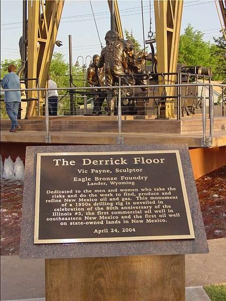 |
| "The Derrick Floor" from http://www.vicpaynestudio.com/v2/Art_view.cfm?art_id=32 |
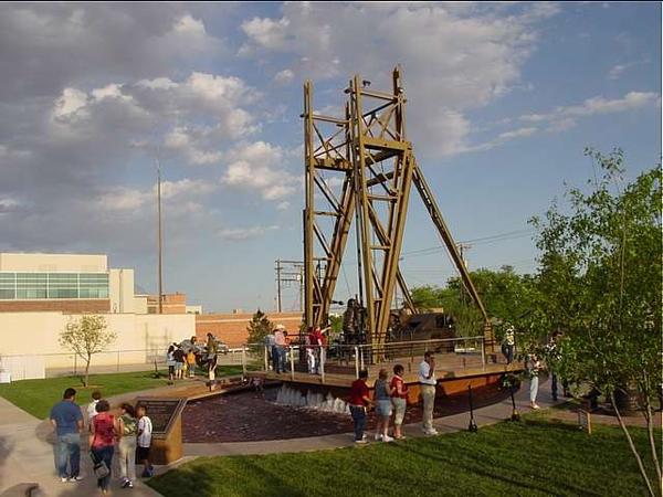 |
| "The Derrick Floor" from http://www.vicpaynestudio.com/v2/Art_view.cfm?art_id=32 |
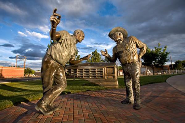 | ||||||||
| "The Partners" located next to "The Derrick Floor". From http://www.vicpaynestudio.com/v2/Art_view.cfm?art_id=93 We loved the fact that they were leaning on the front of their Ford pick-up. |
We had no idea there was significant oil production in southeastern New Mexico, but it makes sense since it is not far from the oil fields of west Texas. In addition to this impressive set of bronze sculptures, we noted several more bronze sculptures on the street corners of downtown. Artesia appeared to be a very interesting and prosperous small community, no doubt aided by the large refinery we could see east of downtown.
Near the middle of town we turned south on US 285, heading towards our destination for the night, Carlsbad, NM.
No comments:
Post a Comment